Showing posts with label hiking. Show all posts

Sunday, 5 February 2017

Walking the Weinsteig Rheinland Pfalz, Germany Stage 4: Deidesheim to Neustadt an der Weinstraße

Walking the Weinsteig: Deidesheim to Neustadt an der Weinstraße Stage 4: 15.5 km; 5 hours; 650 m climb 
February 28, 2016 Weather, dry, cool (9°C), overcast
This stage is fairly strenuous with plenty of scenic variety, including good views over the vineyards south of Deidesheim. The little town has attracted artists and as we walked towards the old Town Hall with its tremendous steps we noticed amusing and atractive sculptures adorning several buildings. Of course if you are with a group or children the figures around the fountain near the station require a stop. We dragged ourselves away from the beguiling menu boards and angled left then into the narrow streets lined with stone cottages. Soon the houses petered out, the road climbed gently between high stone walls on the edge of vineyards and became a rough track. Shortly we left the shelter of the vines, climbing into meadows, and up a wide grassy slope. A glance back revealed that we were already high above Deidesheim and approaching the Pfalzblick restaurant 200m ahead. a popular lunch stop, especially at weekends. Soon we are back in the familiar mix of pines and chestnuts climbing easily, then back down to a small white chapel, the Klausenkapelle, where there are occasionally services. Up again above the village of Königsbach, with its notable church tower. Maddeningly there is a steep descent down steps, with fragile wooden handrails right into the churchyard. We contoured along a series of alleys to an open view of vines, with Gimmeldingen village ahead below. This is a pleasant snack stop with a few picnic bench, especially if the magnificent rose bushes are in flower to attract bees (to fertilise the vines). Though a cold Spring this year, almond trees were flowering around Gimmeldingen. The festival in celebration, with stalls, vino tasting and local foods was postponed until later in March (still very chilly). Our trail headed steeply uphill partly up irregular stone steps. We were feeling quite perky until we reached the steps and climbed to Meerspinnblick, where there is a wooden shelter. Hunger suddenly struck both of us so we perched on a convenient bench where various walkers wished us "Guten Appetit" as we ate our lunch.
We had forgotten the rather demoralising drop into and along the valley deeply into the woods. From  Forsthaus Benejental the real work of the day began, up, along, up into the Scots pine and heather clad hills towards Weinbiethaus. Fortunately we were encouraged by various signposts and indeed  distances and the additional climbing needed did get smaller. En route great blocks of stone and weathered outcrops, clumps of heather and chestnut trees gave way to eerie looking Scots pines and even traces of snow. Eventually the low welcoming restaurant building of Weinbiethaus appeared with the stone tower behind.
Maybe it was the anticyclonic gloominess of the day but both of us were glad to reach Weinbiethaus at 554m, our highest point yet reached on this Weinsteig trip. This is a restaurant run by the Pfalzerwald Verein (Club), not to be missed with excellent hearty meals, drinks, plus homemade cakes, teas or coffees. It was reopened only recently after extensions and rebuilding. As usual we chatted to our neighbours at the long table before tucking into large mugs of milky coffee and sustaining portions of cheesecake (German style).
The determined walker can continue at high level along the marked Weinsteig trail for 7.7km, to the rocky outcrop of the Bergstein, with great views over Neustadt, then a steep descent into the town. The less determined walker can take the shorter (4km), but still interesting route more directly into Neustadt. That February day we had decided to be less determined walkers, despite the calorific input of coffee and cake so we hoisted our packs and followed blue and white striped symbols on the southern side of the Meisental valley. Parts of the trail and several thousand trees had been laid waste but the 'harvesters' and their machines were gone. With a little extra care we reached the outskirts of Neustadt where many sets of steps further tested our knees. Neustadt an der Weinstraße is a real town of some 30 000 souls, one of the many Neustadts in Germany dating back to the 12th century. It is well worth a visit, but that February day we legged it through the town, past the large church and over to the station, catching a train to Mannheim 10 minutes later.

Insert head in figure as appropriate, Deidesheim fountain

Imposing steps to the old Town Hall, Deidesheim
Steps into the vinyards too
Klausenkapelle
 J struggles down the steps
 Almonds bloom despite cool temperatures
Roses attract pollinating bees in sumer
The way of the steps
Neustadt, so near and so far down


Monday, 28 March 2016

Walking the Weinsteig, Rheinland Pfalz, Germany Stage 2: Neuleiningen to Bad Dürkheim

Stage 2: Neuleiningen to Bad Dürkheim, February 12, Distance 17km; Height climbed about 400m; Walking time 4 3/4 hours
Weather: Dry, mist hugging the valley floor, sunny later, temperature 4-9°C, good visibility.
In early February we returned to Neuleiningen to pick up the second stage of the Weinsteig. This is very different with little open country, but the signposting is excellent. This is very important on routes through woodland. Starting in the valley below the town we climbed through woods of pine, beech, or oak with the occasional larch. To the north we glanced back at Neuleiningen, perched on its crag above the incised valley of the  River Eckbach, then on to Battenberg with yet another castle ruin, battered initially by the French in 1689, still used by local nobility into the 18th century. However, what we found much more interesting were its ochre-coloured weathered rocks exposed on the roadside below the ruins. They are signposted off the trail to the right. These curious formations are known as Blitzröhren, thought to be caused by lightning strikes. Modern explanations are that they are due to concentrations of iron minerals in New Red Sandstone which resist weathering.
Back to the route, up through the village and away from inviting offers of lunch it was time to start the long but relatively easy climb using forest paths, liberally studded with white quartz pebbles. Away from the front edge of the Pfälzerwald, up and up leaving the wine villages such as Weisenheim am Berg below on the fertile fault line margins. We met no one today on this part of the  trail and it was still too cool for many birds to be about. After some steady walking we reached  the Jägerkreuz, a memorial to a hunter who died  mysteriously in 1702. Accident or murder? It seemed a good idea to press on and gradually we reached parts of the trail better known to us from earlier walks. Off to our left lay the Ungeheuersee (Monster Lake), in reality a delightful pool, but the Germans like to frighten. No point in a detour today since the typical Hütte which serves food and drinks on summer weekends would still be shuttered and locked for the winter.
We continued gently rising and falling sometimes with glimpses of small settlements like Altleiningen revealed as hill and valley sides open out. At last a few walkers appeared as we approached the first road to cross the Pfalzerwald, south from Neuleiningen, at Lindemannsruhe. The old Forester's House is now  a restaurant, with a cozy atmosphere and tasty local food, as we knew from previous visits. However February days are still too short, so we pressed on up a rough track to the day’s highest point (487m) at the Bismarckturm (Bismarck Tower).  Still surrounded by tall beeches and Scots pines the route returns over rounded hills, past the Teufelsstein (Devil’s Stone) a large weathered boulder and then past moss covered Celtic stoneworks to the edge of the plateau. Finally the trees opened out so we could glimpse the Rhine Plain. At a shelter hut above Kriemhildenstuhl we paused to read the information above the sheer drop into a quarry (fenced off, fortunately). The quarry was used by Roman stonemasons, who left some graffiti, readable from the grassy quarry floor below the steep pathway. Our knees were protesting as we crunched through leaf debris from the chestnut trees down more zigzags into the outskirtsof Bad Dürkheim, a delightful little town, and finally back into the vineyards. Bad Dürkheim is a place to savour and enjoy, where we often take visitors and meet friends, but after a long walk it was time to head home, through the dusk. I'll enlarge on its delights in a later post.
(Otto von Bismarck, 1814-1898 was, at first, a minor figure from Prussia, who through fortuitous circumstances and sheer force of personality, succeeded in uniting the  numerous dukedoms, principalities and fiefdoms into the Pre-WWI country of Germany. He became the first Chancellor. He was revered by many during his lifetime and there was a cult of building towers and lookout points. Though many of these seem aggressively Teutonic in style, they do serve as landmarks especially in forested regions and offer good views.)
Looking at Neuleiningen from the Weinsteig
The Blitzröhren


The hunter's cross memorial

Storm damage hazards are frequent
Teufelsstein has tempting footholds for energetic walkers
Bad Dürkheim's Schloßpark in summer

Monday, 29 February 2016

A few thoughts on step counters/pedometers

I decided to buy my wife a SILVA step counter for Christmas some years ago. It was a good way of checking how far we walked. It cost around €24. A year later Judith bought me one. The devices fastened to our belts. If the counter was not almost vertical it didn't seem to function well and gave ridiculously low values. We could live with this although it was a bit fiddly.
We went canal boating two years ago and I attached the device to the belt of my old gardening jeans. When we returned it was bit late to garden and so the jeans and the step counter disappeared into the back of my wardrobe. I decided I'd lost it and picked up a low priced counter from Decathlon. The company had just opened a shop in Mannheim. If memory serves me rightly this cost €7 or €8. It didn't function well and was very sensitive to where it was placed on the belt. Decathlon no longer sell this device, at least in Germany. I am not surprised because Decathlon strike me as a company offering good value, decent, well functioning clothes and gear.
I read that the two step counters mentioned above were two dimensional pendulum devices and that three dimensional pendulum devices were superior. We bought to OMRON three dimensional step counters for about €20 apiece. These have the advantage that they can put in pocket, even a shirt pocket or hung on a belt. We are most impressed. The counters deliver similar data to GPS devices. We can recommend them highly. 
We have no connection with any of the companies mentioned.

Wednesday, 19 August 2015

Umbrellas for walkers

We walked through the Odenwald forest on Sunday. It was wet. A slow moving cold front dropped  several litres per square metre of rain on the Odenwald. We had bought two Euroschirm (www.euroschirm.com) telescopic trekking umbrellas earlier this year after leaving one old gamp on a train and having another invert itself on the same day. This was their first taste of action. We were both impressed. We unlike others in the party with capes and rain jackets were reasonably dry by the end of the day.

Sunday, 20 July 2014

Walking with luggage transfer along the Weinstraße, Rhineland Palatinate, Germany

We have walked and enjoyed several stages of the Weinsteig a slightly tougher version of the German Weinstraße route. The 165km long route starts just over the border from the French town of Wissembourg and proceeds along the edge of the hills bordering the Rhine to Neuleiningen through Neustadt an der Weinstraße and Bad Dürkheim. The excellent Kleins Wanderreisen offer a 14 day trip for just over €800 pp for two people sharing a room with bed and breakfast in hotels and vintners accommodation, with luggage transfer starting each Sunday. If you want to book your own accommodation Gepäckservice Pfalz will arrange luggage transfer for €20 for one or two persons.

Thursday, 5 June 2014

Walking the Neckarsteig

We walked part of the Neckarsteig a walk above the Neckar Valley between Heidelberg and Bad Wimpfen (124km, 76 miles) recently and were much impressed. The route switches valley sides and so the total height difference over the week or so is about 5000m (16000'). There are organised self-guided trips with pre-booked rooms with luggage transfer available from:
  • TS Touristik Service e.K., 63840 Hausen im Spessart, Germany, T: +49(0)6022 2654744, www.ts-touristikservice.de for €549 pp in a double room for 7 nights.
  • 100% Kanu+Bike, 74239 Hardthausen-Gochsen, T: +49 (0)7264 934900, www.kanu+bike.de, for €599 pp in a double room for 9 nights.
GPX tracks can be downloaded from www.neckarsteig.de.
Near Eberbach

Wednesday, 2 October 2013

Walking in Vogtland

Near our hotel
Last week we spent a week walking in Vogtland, east of Hof and Bayreuth (Bavaria) and stopped in Bad Elster, (Saxony) one of a number of spa towns in the area.  The area is criss-crossed by well waymarked trails. The town of Bad Elster is good base. There are regular concerts, a magnificent baths and some good cafés. There is a basic public transport system: Buses and a railway line south into the Czech Republic and north to the German mainline railway system. The one snag is that the railway station is 3km out of town. None of the normally well organised Germans seems to have thought of a shuttle bus to link the station and the town, so it was Shanks’ Pony which made for a long day.
We walked between 15 and 20km most days through woods and across open fields with good views of the Vogtland hills. For me the two high spots were:
Františkovy Lázně 

  • A good day walking from Cheb to Františkovy Lázně (Franzenbad) passing a volcano investigated by Goethe. The site is marked by a plaque in German. Františkovy Lázně is elegant in a French Empire style and has numerous springs where one can take the waters. They taste healthy, uugh! The Czech - German border is open thanks to the Schengen Agreement.
  • The day we walked across the heathlands to Markneukirchen, a centre of quality musical instrument manufacturing, (The cheap stuff is made in Asia.) The museum there has a fantastic display of musical instruments. It also has an excellent value for money café on the main drag where we made up our missing calories after the exertions of the walk. Prices here are less than farther west, but are still higher than in the Czech Republic which are ridiculously cheap: Three of us ate a three course lunch with a genuine Budweiser beer in a very comfortable restaurant near Cheb for €20 total.

Sunday, 25 August 2013

Walking in the southern Black Forest Day 6 St Blasien to Todtmoos

The view from our hotel window

Open fields and forests

The "monster" at work

The Fairy Glen
Another wonderfully sunny morning, though some of the "spectacle viewers" of the night before, a little short of sleep, had a somewhat jaundiced view of the world. We walked through the town and could stock up on a sandwich for lunch, before diving under the bypass to climb steeply over Lehenkopf with the Bismarck Tower. There were already excellent views of the cathedral and the cloister buildings, so we did not climb the tower, but made our excuses and left. We walked down into the pub at Klosterweiher where we enjoyed a Radler before climbing 2km to the Kreuzfelsenhutte shelter hut to eat our sandwiches. We could have had lunch in the pub, but a beer  and a large lunch slows us up even more in the afternoon. We continued on through forests and around fields containing a bull, a number of cows and calves to climb to the Peace Cross above Ibach where we were promised a view of the Alps. It is more than likely true on a cold clear day, but with the haze it was difficult to recognise anything, though J and C swore they could see snowy peaks through binoculars. We crossed open country and climbed into forest where we were treated to a display of modern forestry techniques. A monstrous machine was reducing large trees to matchsticks. After another a stretch of forest we crossed the main road to walk steeply into the Hohwehraschlucht  (Upper Wehra Gorge). The last part of the route before Todtmoos was an interesting path through a “fairy glen”, a babbling brook, pools and light and shad from a variety of trees.

Saturday, 24 August 2013

Walking in the southern Black Forest Day 5 Fischbach to St Blasien

Breakfast at the hotel was reasonable but a bus party had played the flight of locusts just before us and pickings were rather thin. Neither baker nor butcher were within view as we left the Gasthof Hirschen, so we could not buy sandwiches for lunch. Our first priority was to buy victuals. The wide farm track by the hotel led to a gentle climb through the forest over Bildstein peak (1130m) where we had good views of Lake Schluchsee. We dropped down a winding narrow path down to Aha Bahnhof (Railway station) on the lakeside. The kiosk there was not yet open, so we went on to Aha and bought dry Brötchen (rolls) in the kiosk at the start of the hamlet. We still had a tin of sardines.  As we found out there was only one other chance before St Blasien to obtain refreshments. We walked round the lake on a wide unsealed road with many other walkers and cyclists, who were only going as far as the café at Unterkrummen (4km). After the café we climbed over Krummer Kreuz on forest roads. Although it remained dry the weather was overcast and much cooler. There were a number of traditional Black Forest farmhouses with their bonnet-like roofs stretching along the Halbmoosbächle Valley. In Althütte we caught glimpses of what we decided was Lake Constance. A steep drop past the Windberg Waterfall brought us into St Blasien on a pretty but difficult path, in another gorge much strewn with large trees blown down in a great storm. We arrived at the hotel by 16:00 and spent some time out in the town victualling, so did not have our usual late afternoon siesta. St Blasien was in the hands of amateur thespians, some of whom we observed over an excellent coffee and cake. The town organises an annual son et lumière event and that night was the first night. Our hotel, Dom Hotel was in front of the cathedral and at the back of the viewing stands, but within hearing distance. The event started at 21:15, finished shortly before midnight and the audience must have been glad of woolly jumpers and/or quilts. Temperatures were low below 10°C. I was worried I wouldn't be able to sleep, I dozed off while watching the beginning and slept well until early the next morning.
Climbing out of Fischbach

First view of Lake Schluchsee

Black Forest farmhouse

Descending to St Blasien 

Friday, 23 August 2013

Walking in the southern Black Forest Day 4 Schattenmuhle to Fischbach

The hotel did not offer a breakfast buffet as was usual at the other hotels, but we had a good choice of ham, Wurst, cheese, jam and honey to go with rolls, bread, coffee and tea. There were no shops for miles so we enquired whether we could purchase three dry rolls to make our sardine sandwich lunch and were given three. We left the hotel and climbed steeply then followed a high level path via Räuberschlössle - the Robbers’ Little Castle which is the remains of a castle on a peak later taken over by gangs of low life types. It would be an ideal place to set a Swallows and Amazons story. We walked on and passed the Stallegg hydro power station, one of Germany’s first hydropower stations. It did not appear to be functioning when we were there. The dam was empty. Perhaps the station was being maintained. During the next kilometers into Lenzkirch crisscrossing a former railway line now used as a cycleway it seemed that we no sooner reached the summit than we dropped again in order to climb back up again. I suspect it is better to follow the cycle path into Lenzkirch and would have done this but my companions had moral fibre. We had to walk the whole route with no compromises. We had a coffee break in the Kurhaus before we began the long climb to Fischbach over Fischerbacher Höhe (1101m). Initially it was very pleasant in the shady woods up to the Geopark with its mini library and chunks of local rocks, but when we came out in the open fields by the Cyriak Chapel walking there was some sweating and puffing. The road seemed to go on forever. We dropped into Fischbach and arrived at the Gasthof Hirschen after 22.5km with 600m climbing. We very were pleased to be offered a Radler as a welcome drink.
The library at the Geopark site

Discussing erratics

Nothing better than a shandy after a long day

Thursday, 22 August 2013

Walking in the southern Black Forest Day 3 Blumberg to Schattenmuhle

Schleifenbach
Wutachmuhle
In the gorge


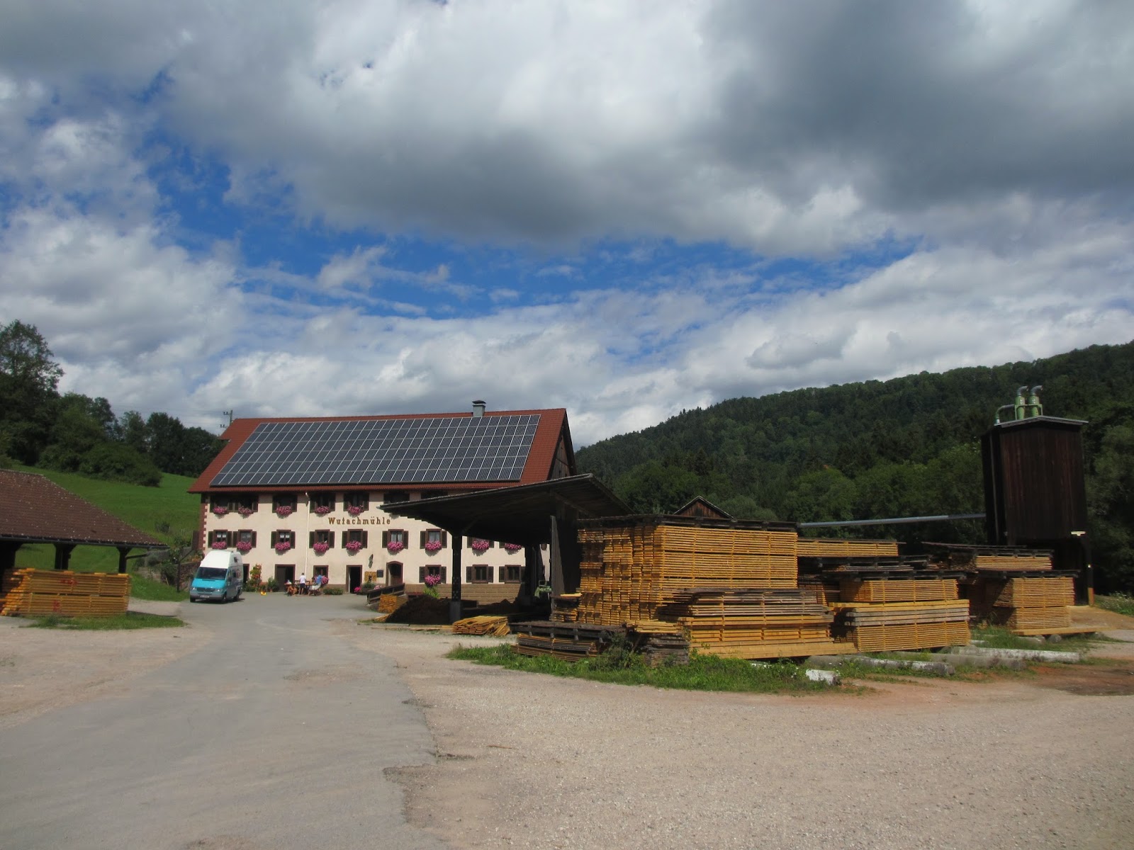
We had trouble with the Hotel Hirschen’s WiFi system. This may be related to the devices we were using: mobile phone, netbook or e-book reader. Whether this is a language problem, because our devices use English or whether the signal was not strong enough, we don’t know. In our experience it is not easy to use WiFi away from home as we found in several hotels underway. This is a plus point in our opinion. However mobile phone coverage in the gorge is very patchy as well, perhaps the perfect excuse when the boss complains that you could not be reached. More importantly, we enjoyed an excellent buffet breakfast, bought three filled rolls for lunch at €4 for the lot and walked back onto the trail. All of our hotels were within a few hundred metres of the trail. We followed Hauptstrasse west and then walked straight on to go down a steep path on the left. After some zigzags with serious exposure we reached a ladder with about 20 steps by the Schleifenbach waterfall – an impressive dark cove of rock. A climb followed along a forest and field path to the pretty village of Achdorf. We walked through the village  to reach the fields; followed a minor road, then crossed the Wutach to go through woods and clearings to reach the Wutachmuhle, an old mill. We wandered through the timber yard to follow the path in to the narrow, twisty Wutachschlucht. The path is technically difficult from time to time over tree roots, climbs very steeply over loose greasy stones, drops to rock shelves by the river and returns high over the river with a cliff face on one side and a vertical drop on the other. It is a spectacular experience, certainly no after lunch Sunday stroll. The route is popular and was busy with walkers coming towards us which slowed us down on the narrower sections. There was a lot of up and down before the day ended in the remote Gasthaus Schattenmühle, cut off from the outside world. The kitchen closed at 8 pm. Carbo-loading was the order of the day, so we ate excellent Rösti , topped with pork steaks or Black Forest Ham, followed by Kaiserschmarren. Our room was simple, but after 20km  and 380m climbing in about seven hours it was all we needed.


Wednesday, 21 August 2013

Walking in the southern Black Forest Day 1 and 2 Stühlingen to Blumberg

Day 1
We drove down to Stühlingen and left the car there. We were lucky that our first hotel: Hotel Rebstock in Stühlingen was the epitome of the historic Black Forest inn, hotel staff in local costume. We ate very well on Saturday night. The food and drink complimented the amazing table decor.  
Day 2
We left early on Sunday morning after an excellent breakfast as the sky cleared and the sun came out. We walked along the German-Swiss border gently burping Black Forest Ham until we were diverted across the Wutach into Switzerland. There was logging on the German side. There were no border controls as Switzerland although not a member of the EU has signed the Schengen Agreement. The temporary signage was excellent. We crossed the line of the Sauschwänzle Bahn, the pig’s tail railway, a museum railway that climbs via a series of loop tunnels and viaducts up to Blumberg. As we looked at the halt buildings by the road side we heard the familiar noise of a steam train climbing the gradient towards us. We waited and watched a Rumanian steam locomotive probably as old as we are pull the morning train from Weizen to Blumberg. Gradually we climbed along the precipitous side of the Wutach Valley along a narrow, rutted and stony path. In the growing warmth of the morning we were grateful for the woodland. We were later amused to read a notice put up by the Black Forest Club explaining that this section was difficult and dangerous. We should take care and notice that the route is divided into sections to help the Bergwacht (Mountain Rescue) find us more quickly if we put a foot wrong. A little late we thought. The route lead us away from the valley over Buchberg Hill through open fields. It was very hot and we were glad to reach the forest on its upper slopes. We had a short break at the viewpoint overlooking the village of Achdorf which we would visit the next day and then wandered into Blumberg and the Hotel Hirschen. This was a much more modern hotel, but equally comfortable and with good food and excellent local beer. 
22km, 540m, Time taken: 8h


Tuesday, 20 August 2013

Walking in the southern Black Forest Introduction

Some months ago a former colleague suggested we spent a week walking this summer. We had been cycling together before, but I think she was tired of waiting for us at the top of hills and maybe she hoped we would be quicker on Shanks’ Pony. (We weren’t or at least I wasn’t) 

We thought we’d stay in Germany: There is a lot of excellent walking in Germany and we speak the language. After some thought we settled on the Schluchtensteig in the southern Black Forest. (For those who are not familiar with the language of Goethe: Schlucht is a canyon or a gorge. Steig is a steep track, i.e. Schluchtensteig is a track through a gorge. The route has been laid out by the Southern Black Forest Nature Park, and the Black Forest Club. It is 119km long and runs from tiny Stühlingen on the Swiss border to Wehr on the Upper Rhine. The route falls well into 6 days, i.e. about 20km a day. Fitter and faster walkers can complete it in five days, but the views are worth savouring. Most hotels on the route offer baggage transfer to the next hotel, but not a sag wagon that follows the walker, though some hotel landlords might take you as well as your bag if necessary. After looking at various possibilities we booked a trip with Kleins Wanderreisen GmbH. The company’s website and approach seemed to be a good one and we were not disappointed. We did “cheat” as a Canadian lady we met in Wehr suggested in that we did not carry our gear, but at 70 plus we are both beginning to enjoy some of the perks age brings. Our luggage went on before and we followed carrying day rucksacks.  

Sunday, 18 November 2012

Why fly to New England?

We have enjoyed a superb autumn/fall this year and if you wish to enjoy walking through golden woods with good food and wine, then it is worth thinking about southwest Germany in October. The photographs below were taken over the last month or so in the vineyards of Rhineland Palatinate, in the Löwensteiner Hills near Heilbronn, in the Odenwald and in the Viernheim forests.


Saturday, 27 October 2012

Die Weinstraße

The Pfälzer Weinsteig (Palatinate Wine Trail runs for about 160 km (100 miles) from Neuleiningen to the Weintor at Schweigen-Rettenbach, just north of Wissembourg in Alsace. The route traverses the foothills of the Pfalzerwald (Palatine Forest) through vineyards, past castles and Ludwigshöhe, a Royal Bavarian summer residence. The climate is warm here in the summer with almond, fig and edible chestnut trees. This is a major German wine growing area. It is especially fine in October when the leaves on the grape vines change colour from deep green to yellow, orange and deep red. It is a bit late for this year, but next year maybe? You will need some time to sample the wine and the local food which is rural, robust and simple, but not to be missed - Saumagen (pigs' stomach stuffed with hotpot and then sliced and grilled or  fried. This is the favourite food of Helmut Kohl, the former German Chancellor.), liver dumplings, Bratwurst, sauerkraut… The trail can be easily walked in either direction in 10 days - about 16 km and 700 m, just 2000' a day. You can expect to pay about €80 a night for a double room with B&B. Practically every village has a wine festival in the autumn, so booking head has a lot to recommend it. The organisations whose websites follow will help you find rooms: www.deutsche-weinstrasse.dewww.suedlicheweinstrasse.de or www.pfaelzer-wanderwege.de for details of pre-booked holidays with luggage transport, allowing you to just carry a day sack with a picnic and a waterproof.


Thursday, 24 May 2012

Pembroke Coastal Path Introduction

About thirty years ago in her former life as a geography teacher which included running Duke of Edinburgh's Award courses, Judith took a party of kids to Pembrokeshire. She was much impressed by the coastal path and when we looked at where we wanted to walk this spring she suggested we walked the route. We decided to have a self-guided holiday rather than going on a group trip. Although we have walked carrying all our own gear in the past we did not wish to this time and so looked for a company offering pre-booked tours with luggage transfer. Fortunately the first company in the list was Celtic Trails.* We booked a ten day trip with them. A few days before our departure for Wales we received a thick envelope containing a file with full details of our trip including instructions and/or maps of how to get to the accommodation, a guide book and two OS maps. From what we can gather from talking to other walkers in our overnight accommodation at least one company does not offer maps and a guide and does not go into detail
We had specified walking around 10 miles a day which was good choice for our roughly 70 year old bodies. The Coast Path is tough at times with a number of descents and ascents across bays and over headlands.
*Just to stress we have no financial interest in Celtic Trails.

Hello

For years we have cycled in summer and done some walking in winter, either with the Odenwald Club or our cycling club the ADFC or on organised tours with the Ramblers' Association Spain and Italy, but have limited our longer trips to the Christmas period. Recently we have decided that as long as we are able we will try to go on holiday in the autumn and spring. We wanted to write about these trips. The ideal would be an equivalent to the Crazy Guy on a Bike website. We do have a cycling blog, but we don't want to dilute the bike content, so decided to start an infrequent blog where we can ramble about our rambles.